Potato Late Blight – Part 2
Field assessment of potato late blight from UAV-based multispectral imagery
Remote Sensing | AI | Biodiversity Monitoring
This site showcases my work in remote sensing, AI, and ecological monitoring. Explore blog posts and tutorials on satellite and UAV data processing.
Jorge L. Rodríguez, et al.
In submission, 2025
Project page / Code (Coming soon) / Preprint
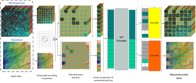
FLORO integrates multispectral and elevation data into a Vision Transformer model for scalable vegetation structure estimation, dryland biomass monitoring, and biodiversity analysis.
Field assessment of potato late blight from UAV-based multispectral imagery
Field assessment of potato late blight from UAV-based multispectral imagery
Image-based Cirrus correction of Landsat 8 imagery